


Flood Protection Information
These web pages will provide flood information for the City of Linwood. Click the links below to find your flood zone, prepare for flood hazards, get advice on constructing or renovating your home to make it more flood resilient, and to access additional flood management information.
Linwood is participating in the National Flood Insurance Program’s Community Rating System (CRS). This incentive program, administered by the City and through municipal action, enables homeowners to receive discounts on flood insurance. This page will be continually updated with new flood information.
Program for Public Information
Program for Public Information
The City of Linwood has elected to participate in a Program for Public Information (PPI) for flood hazards comprised of a number of towns in Southern New Jersey. The Program for Public Information has brought together an array of community members and institutions to help raise awareness of flood risk and flood damage. These members meet at least twice a year to discuss the flooding hazards facing Linwood and other communities and to develop a plan to bring this to the public’s attention.
While undertaking a PPI will bring tangible and intangible benefits in terms of hazard education and connecting residents to resources, the Program is also a qualifying activity for the Community Rating System (CRS) administered by FEMA’s National Flood Insurance Program (NFIP). The CRS incentivizes communities to take action to prevent flood damage and promote activities that result in the reduced insurance claims from flooding events. Linwood is participating in this program to provide flood insurance discounts to its residents in flood hazard areas, with steeper discounts available for policy holders in the Special Flood Hazard Area (SFHA).
- What’s My Flood Hazard? How Do I Get Insurance?
- Protect People and Property from Flood Hazard
- Build Responsibly and Get Permits Before You Build
- Protect Natural Floodplain Functions
- Hurricane Season Tips
What’s My Flood Hazard? How Do I Get Insurance?
Though Linwood is located inland from the barrier islands, portions of Linwood are at significant risk of flooding. The eastern and western sections of the City are bordered by tidal waters. Western Linwood is at risk of flooding from the Patcong Creek, which is a tributary of the Great Egg Harbor River. The eastern section of Linwood has large sections of marshland that are prone to flooding. Coastal flooding can be experienced due to storm surge and high tide events and will likely to be more pronounced as sea level rises. When combined with stormwater flooding, storm surge can lead to prolonged and exaggerated flooding conditions. Even if your residence is not located on or near to the water, your home may still be at risk for flooding. Flood insurance is recommended for all structures in areas of flooding risk.
Damage from flooding is not covered under your homeowner’s insurance policy. If you want insurance protection from flooding for your home, you will need to contact your insurance agent to find out what flood insurance policies are available to you. The maximum amount of coverage for a single-family unit is $250,000, with coverage for contents up to $100,000. Your flood insurance rate is based on a number of factors, but there are a number of steps that you can take to reduce your premium such as elevating your home or installing flood vents.
Your risk of flood hazard is most easily discernible by its location on a Flood Map. Flood maps created by FEMA take various factors into consideration (such as elevation and proximity to the water) in determining what areas are most vulnerable to floods for flood insurance purposes. You can see what flood zone you are in by clicking here: https://msc.fema.gov/portal
Upon clicking the link, type in your address and click the search button. You will be brought to a page that shows your property on a Locator Map and indicates the number and date of the most recent effective flood map. Click the button with the blue magnifying glass that reads “View Map”. This will open a new tab or window with a copy of the most recent effective flood map, and you can discern your home’s flood zone based on the map. If it is within the dark shaded region, your home is within the SFHA and flood insurance is required if you have a federally-backed mortgage. The dark shaded area will also have a corresponding elevation, indicated by “EL 9” or “EL 10”. This indicates the height of the base flood (in feet).
If your home is located in a region marked “Zone B”, your home is located within the 500-Year Floodplain, and you may experience up to one foot of flooding during a 100-year storm. Though you are not required to purchase flood insurance, you may still be at risk for flood damage. If your home is located in “Zone C”, your home is located outside of the 500-Year and the 100-Year floodplain. Note that placement within “Zone C” does not mean that there is no chance of flood damage or that your property will not be at a significant risk for flood damage in the future. Local drainage conditions and sea level rise may create flood conditions or the possibility for flood damage that may not be accounted for by flood maps.
Because the existing flood maps for Linwood and many other communities are more than three decades old, FEMA has undertaken a new flood insurance study to determine whether there should be changes in flood zones. The preliminary results for this study have been published but have not yet been declared effective for insurance purposes. However, the City uses the preliminary maps for regulation and building purposes. These flood maps are based on the most recent data, and may demonstrate a more accurate indicator of flood risk than the existing maps. Use the web tool here (http://www.region2coastal.com/view-flood-maps-data/what-is-my-bfe-address-lookup-tool/) to determine your property’s new flood zone once the new maps become effective.Flood insurance can only be purchased through an insurance agent. FloodSmart.gov offers a free tool to help you find an insurance agent.
Note that there will be a 30-day waiting period (with few exceptions) for new policies, so don’t wait until the next big storm is forecasted to purchase your flood insurance!
Protect People and Property from Flood Hazard
It is likely impossible to bring the risk of personal or property damage to zero in an area where a widespread and damaging hazard is occurring. However, steps taken to mitigate the damage from a storm event and careful advance planning will pay significant dividends whether you live in or out of the flood zone or the direct path of a storm.
The following questions can be used as a guide for preparing for flooding events:
- Do you understand your flood risk? Are there any drainage issues on your property that you can mitigate before a storm hits?
- Have you reduced the possibility of structural damage to your home? FEMA has produced publications describing best practices to make your home less susceptible to flood damage. A structure can be floodproofed through elevating the structure and its critical building systems, and/or by installing flood vents to allow for the drainage of water in a flood situation. Contact your Construction Official to determine which best practice that is right for you.
- Do you have an Evacuation Plan for you and your household to follow?
- Do you have an emergency kit prepared and ready to use?
The Atlantic County Office of Emergency Preparedness manages ReadyAtlantic.org, which provides many resources for dealing with questions you may have about preparing for flood events and other emergencies.
Build Responsibly and Get Permits Before You Build
If you’re developing property in Linwood or making substantial home improvements, it is imperative to have the necessary permits to do so. Linwood’s Construction, Zoning, and Code Enforcement Office can provide guidance on navigating the construction code and is equipped to answer questions you may have about flood-related construction improvements. The main page for the City’s Construction, Zoning, and Code Enforcement office is here: http://www.linwoodcity.org/mainpages/construction.asp
Contact information for the Building and Zoning office can be found below:
Alex Bauer, Floodplain Manager
Telephone – (609) 926-7992
abauer@linwoodcity.org
Be mindful that your property may be subject to a State permitting process under certain conditions, such as waterfront development. If the specifications for your project exceed the requirements set forth in Linwood’s zoning code (https://ecode360.com/13240120), a zoning board meeting may be required to acquire a variance from the code needed for the development of your project. If you’re building or making substantial improvements to a residential structure, your structure and its utilities must be elevated to at least one (1) foot above the base flood elevation.
Be mindful that Linwood’s flood hazard ordinance regulates substantially damaged projects, whereby improvements, reconstructions, or rehabilitations are considered “substantial improvements” if the cost of restoring the structure to a pre-damaged condition equals or exceeds 50% of the market value of the structure before the damage occurred. Substantially damaged structures are treated similar to new construction and will trigger various regulatory requirements, so please consult with the City, your architect, engineer, or planner before undertaking a reconstruction.
Protect Natural Floodplain Functions
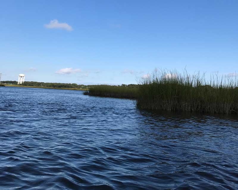 A large portion of land in the City’s Special Flood Hazard Area is in its natural state and performs natural floodplain functions. Floodplains in a natural state provide important benefits, such as absorbing and detaining floodwaters, preventing damage from erosion, and providing natural habitat for sturdy wetlands landscape plants. In addition, natural floodplain features can be more effective in the long run for controlling flooding than artificial structures.
The natural functions of the floodplain are threatened not just by development, but also by human activities outside of the floodplain. Stormwater from the upland portion of Linwood drains to the waterways in the City. As a result, the City’s waterways and wetlands are vulnerable to various types of pollution that could impair their functions. Because Linwood’s water resources are so important for the City’s economy and recreation offerings, protecting the natural aspects of the City’s floodplain are especially important.
What Can You Do?
- If you’re improving your property, consider using rain gardens or using permeable surfaces and reduce the amount of fertilizer your lawn needs
- Refrain from littering and dumping pet and yard waste into City drainpipes
- Safely dispose of hazardous materials and certified drop-off locations rather than down the drain
- When boating or travelling in the City’s waterways, be mindful of No-Wake zones and landing watercraft on marsh grass
 Accessibility Statement